


With the development of electric vehicles, the upgrade of car hardware and software, and the addition of more sensors, cars can provide people with a new driving experience that is different from the past. During my time at Huawei, I participated in the innovative design of the next-generation smart cockpit experience. In this project, based on maps and autonomous driving, we explored many new driving scenarios and provided inspiration for future design possibilities.
Client: Huawei
Role: 3D Design , Unity Programing , UI/UX
Click the video to watch or watch on Youtube
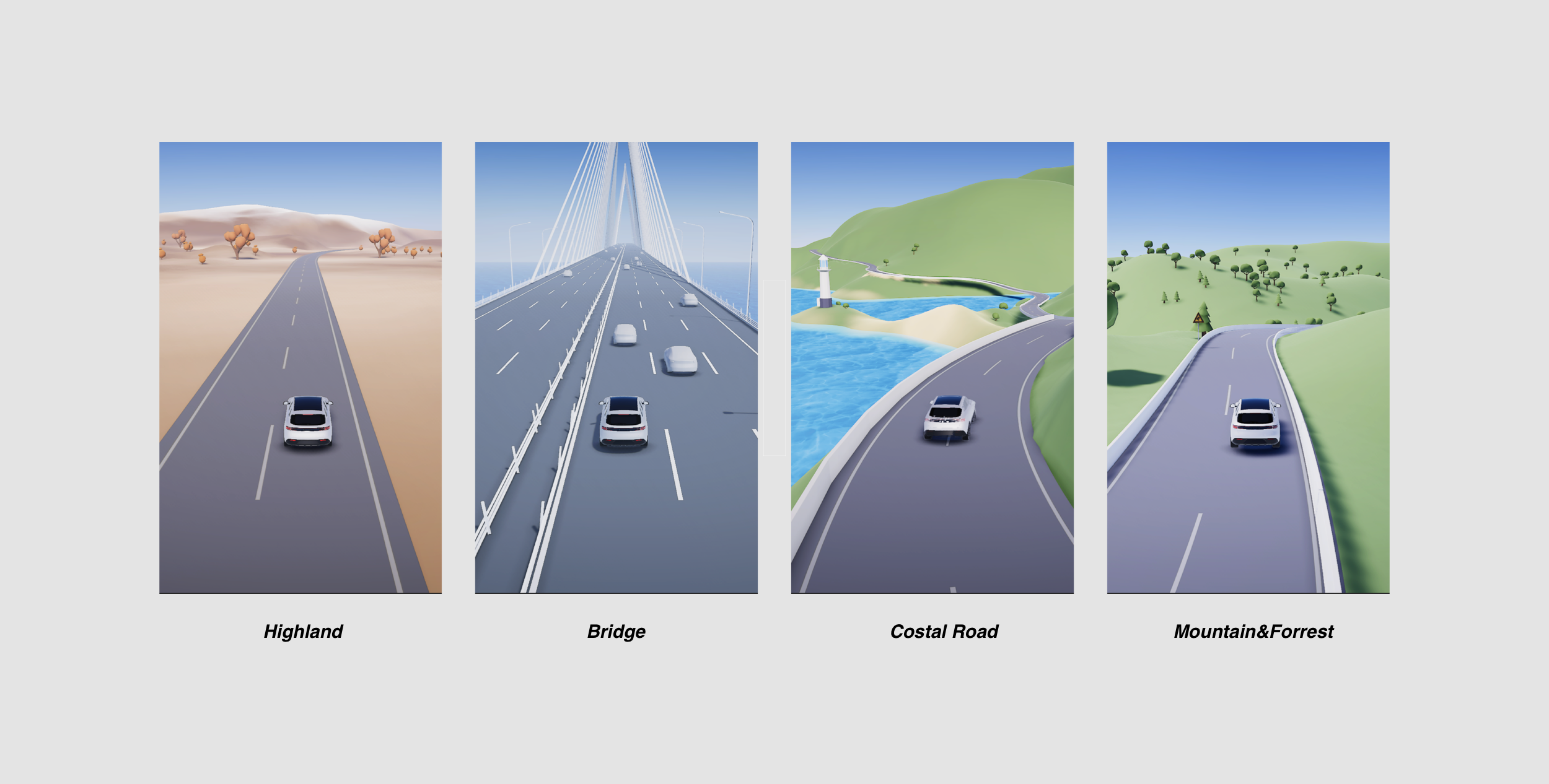
Most of the current maps are highly abstract and much information is lost in the process of abstraction. We hope to make maps more accurately reflect the real environment and terrain information. Therefore, we use the height map of the real terrain, and the colors of different landforms, trees, water systems and bridges to describe the real environment. When the drivers are using this authentic 3D map, they can better understand the real environment.
Since the assisted driving system has only gradually matured in recent years, people have great uncertainty about the driving ability of the machine. We hope to increase the driver's understanding of the current environment by presenting road and traffic participant information more actively and adaptively. Through dynamic camera movement in the 3d map, we present the road and traffic participant information that users need to care most about in the map.
At present, driving, parking, and vehicle control usually work independently and users need to jump between different functions while driving. We hope to provide a more continuous driving experience and eliminate the sense of disconnection in the experience. We provide a more seamless driving experience by connecting driving, parking, and vehicle quick controls.
In addition to providing a rich driving experience on open roads, we are also considering providing drivers with more assistance functions on closed roads such as racing circuits. For example, use the vehicle's map building capabilities to create a racing track map in real-time, and establish a car-to-car connection so that different vehicles can share location and other information.
Most of the 3d elements in the scene were created in blender and the landscape was created with the Unity Terrain Tools. I also collaborated with 3D designers to create some other 3d assets such as car models and city roads. To make the scene intractable, I wrote the code for the following parts:
Car controller
Waypoint navigation system
Car Radar and Distance Control
Traffic light control
Pedestrian AI
UI system
Some of the models were made in 3d modeling tools such as blender and then exported as a .fbx file to import to unity. The unity terrain tool was also very useful for building the basic landscape and adding foliage to the terrain.
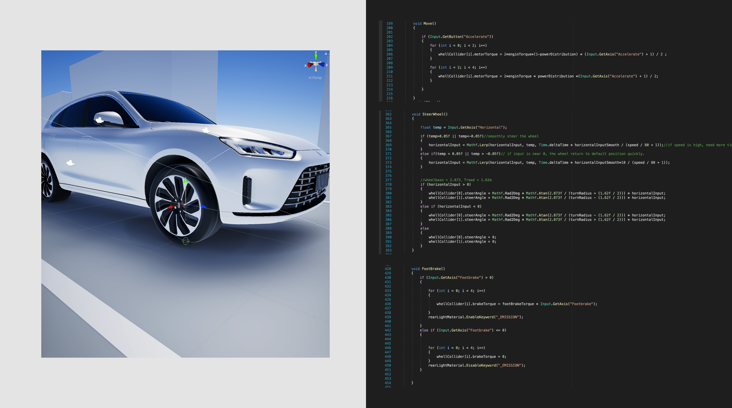
The car can be controlled by either keyboard or a PS4 controller. I use the unity wheel collider component, so it’s possible to add torque and steer the wheels by reading the input data.
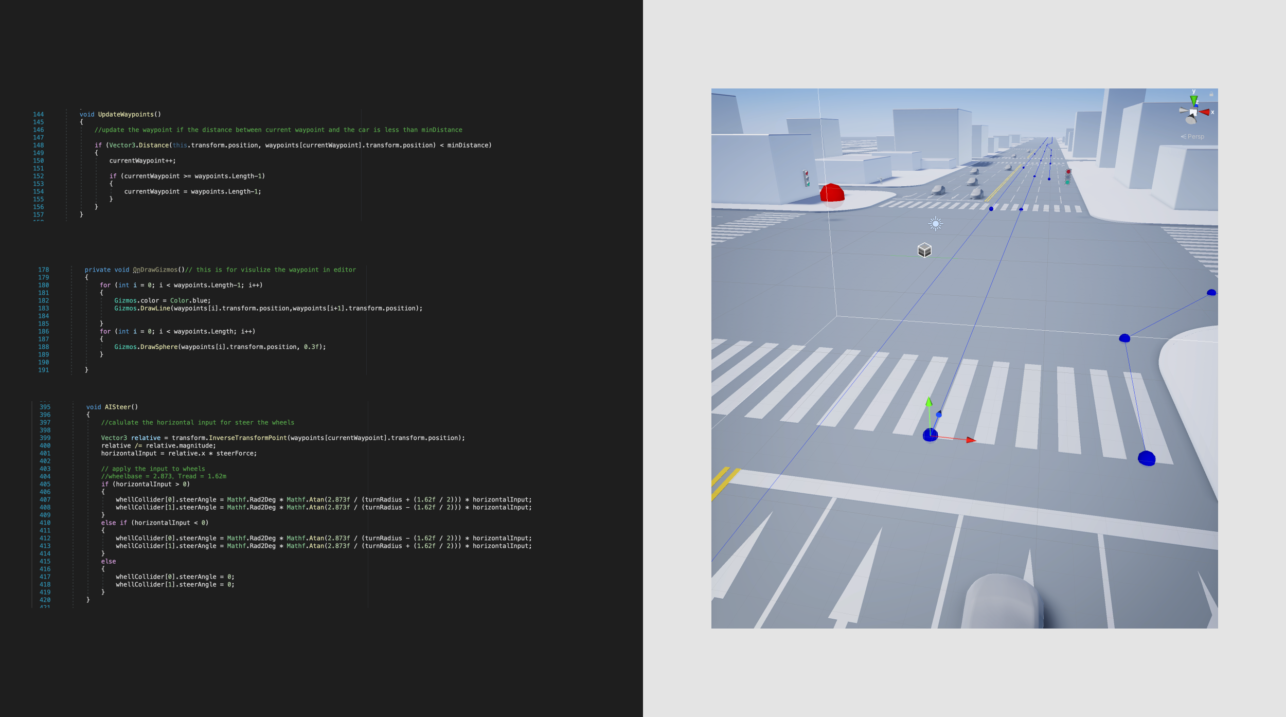
We don’t want to animate the cars one by one, so I made an AI car system that uses the waypoint system for updating destinations for each car. Once the car reaches the current waypoint, the waypoint will update to the next waypoint, so the car will always follow the route.
The AI car can auto-steer and move along the waypoint, but they will hit each other in some cases. So with the help of the unity’s built-in RayCast ability, a ray can be used like a radar for detecting the distance between obstacles. While the distance is too close, the brake force will be added to the wheels to avoid collisions.
For the pedestrian AI, this time I used unity’s nav mesh system. A nav mesh agent component was added to the pedestrian and can very easily navigate on the prebuilt nav mesh. Several waypoints were set to randomize the destination of each pedestrian.